-
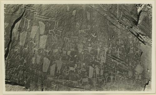 Inscriptions right bank, Glen Canyon below Smith's Fork
 Photo shows ancient Indian petroglyphs on the right bank of the Colorado River in Glen Canyon below Smith's Fork, San Juan County, Utah.
-
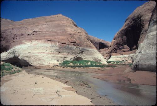 Glen Canyon Reservoir, Willow Gulch, Utah [1]
 Willow Gulch at first side canyon below 40 Mile [Gulch]. 8-8-90. [Note the high water mark from Lake Powell on cliff side]
-
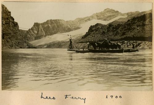 Lees Ferry, 1900
-
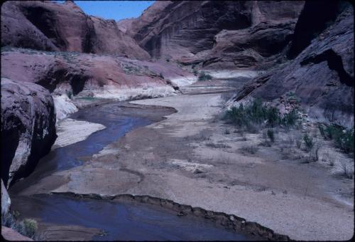 Mudflat at Willow Gulch, Utah
 Lake Powell mudflat. Willow Gulch. 5-19-00. [Note the white on the banks, indicating high water mark from Lake Powell]
-
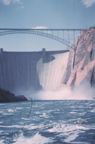 Glen Canyon dam and bridge
 Photo of a view of Glen Canyon Dam and the bridge over the Colorado River, taken during one of Aaron Belnap Ross river trips in June of 1965.
-
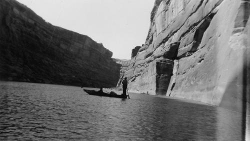 Norman D. Nevills' August-September 1938 San Juan River expedition
 Photo shows the river and walls of Glen Canyon, during an expedition organized by Wesley Heath that Norman D. Nevills took down the San Juan and the Colorado to Lees Ferry, August 23 to September 3, 1938. Precise location unidentified, but probably in Glen Canyon
-
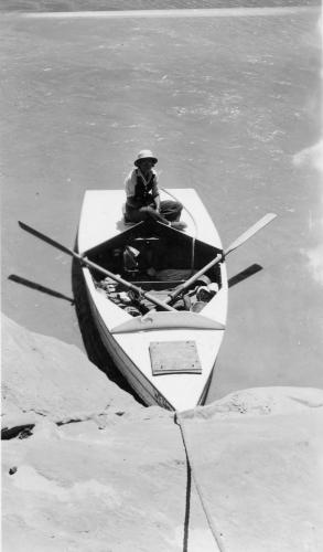 Norman D. Nevills' 1938 Green and Colorado Rivers expedition.
 Photo shows Elzada Clover, member of the 1938 Green and Colorado Rivers expedition led by Norm Nevills, sitting on the WEN at Hole-in-the-Rock Crossing, Glen Canyon
-
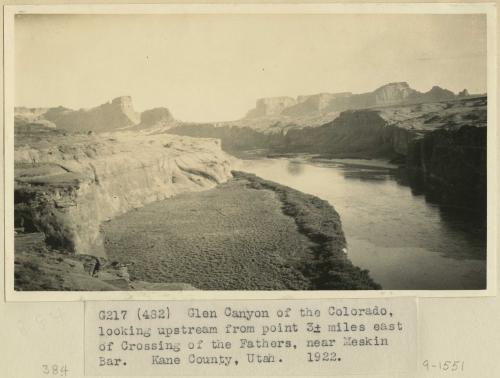 Glen Canyon of the Colorado, looking upstream from point 3 miles east of Crossing of the Fathers, near Meskin Bar. Kane County, UT. 1922
-
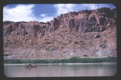 Glen Canyon scenery
 Photo shows a raft in Gus Scott's party on the Colorado River in Glen Canyon, during a river trip in 1953.
-
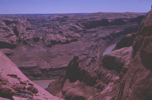 Colorado River from above Hole-in-the-Rock
 Photo shows a glimpse of the Colorado River from above Hole-in-the-Rock. Photo taken on the first day of an Escalante Canyon - Glen Canyon river trip in April of 1963.
-
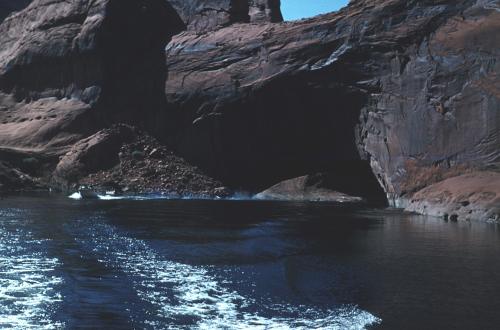 Gregory Natural Bridge during lake rise
 Photo shows Gregory Natural Bridge, located on Fifty Mile Creek near its mouth with the Escalante River, Glen Canyon National Recreation Area, Kane County, Utah. Photo taken on an expedition in September of 1965 during the rise of Lake Powell.
-
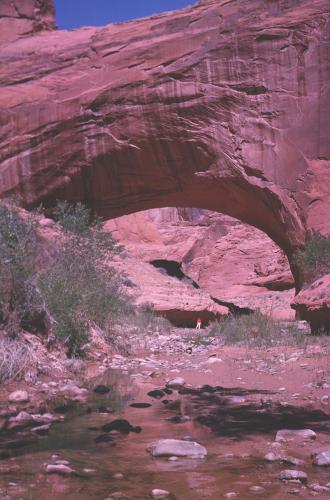 Gregory Bridge, Marie under bridge
 Photo shows Gregory Natural Bridge. Photo taken on the second day of an Escalante Canyon - Glen Canyon river trip in April of 1963.
-
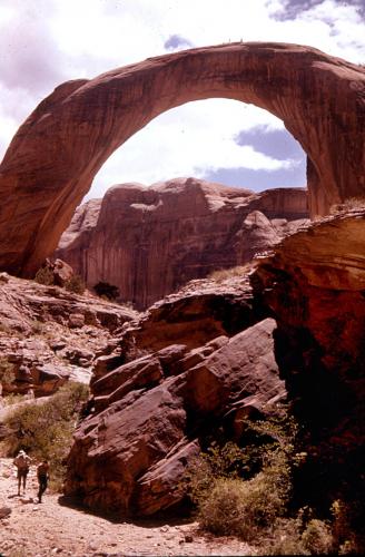 Rainbow Bridge
 Photo of Rainbow Bridge in Bridge Canyon, taken during a SOCOTWA river trip in May 1962. Note people on top of bridge.
-
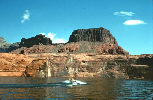 Castle Butte, circa 1985
 Photo shows boats on Lake Powell in the 1980s. Castle Butte in background.
-
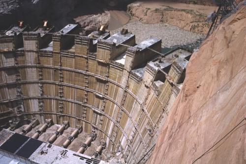 Rising dam and incomplete power plant, taken from south side of Glen Canyon Bridge
 Photo shows work on the power plant and the rising Glen Canyon Dam in August of 1962.
-
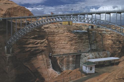 Glen Canyon Bridge
 Photo of the Glen Canyon bridge with the Glen Canyon Dam under construction in July of 1960.
-
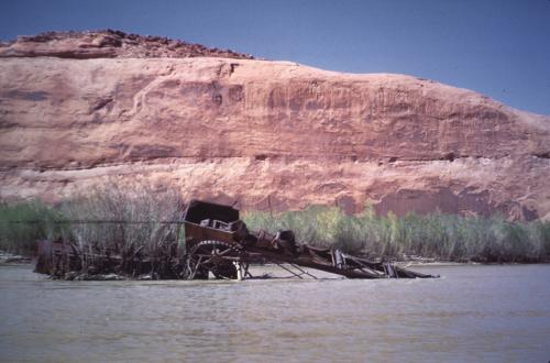 Stanton Dredge
 Photo of the remains of an abandoned Hoskinini gold dredge in Glen Canyon at mile 121.4 above Lees Ferry. Site visited by Howard Foulger's party in May of 1951.
-
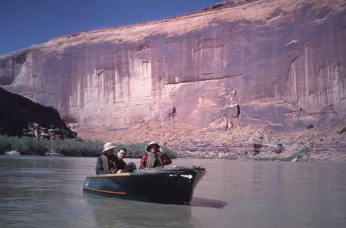 Tapestry Wall
 Photo of the Tapestry Wall along the Colorado River in Glen Canyon, visited by Howard Foulger in May of 1951.
-
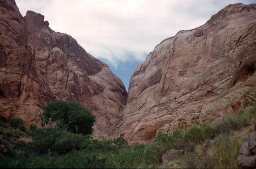 Hole in the Rock, mile 84.5
 Photo shows a view of Hole in the Rock from the Colorado River, during Marjorie Paul's trip through Glen Canyon in May 1951.
-
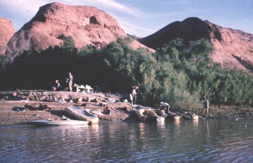 Henson Creek Camp on Smith Bar, first night
 Photo shows a scene along on the Colorado River in lower Glen Canyon, in August, 1952.
-
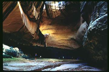 View of the "Cathedral in the Desert" from the entrance
 Photo of the view from the entrance of the Cathedral of the Desert in Glen Canyon, probably in June of 1964.
-
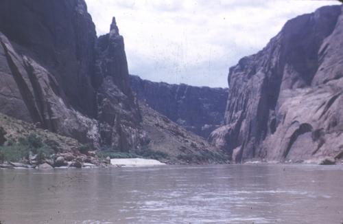 Lower Glen Canyon
 Photo shows a scene along on the Colorado River in lower Glen Canyon, in August, 1952.
-
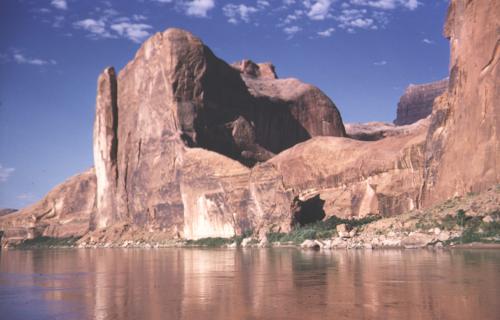 Hite - Hidden Passage and Glen Canyon, early morning, Navajo sandstone, 1958
 Photo shows the Navajo Sandstone cliffs around the entrance to Hidden Passage, along the Colorado River in Glen Canyon, with sandstone cliffs. Taken by geologist William C. Bradley during a river trip in 1958.
-
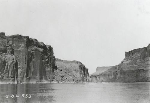 Glen Canyon
 Photo shows a scene along the Colorado River in Glen Canyon, Utah, during the Galloway-Stone river trip in September-November, 1909.
 Inscriptions right bank, Glen Canyon below Smith's Fork Photo shows ancient Indian petroglyphs on the right bank of the Colorado River in Glen Canyon below Smith's Fork, San Juan County, Utah.
 Glen Canyon Reservoir, Willow Gulch, Utah [1] Willow Gulch at first side canyon below 40 Mile [Gulch]. 8-8-90. [Note the high water mark from Lake Powell on cliff side]
 Lees Ferry, 1900
 Mudflat at Willow Gulch, Utah Lake Powell mudflat. Willow Gulch. 5-19-00. [Note the white on the banks, indicating high water mark from Lake Powell]
 Glen Canyon dam and bridge Photo of a view of Glen Canyon Dam and the bridge over the Colorado River, taken during one of Aaron Belnap Ross river trips in June of 1965.
 Norman D. Nevills' August-September 1938 San Juan River expedition Photo shows the river and walls of Glen Canyon, during an expedition organized by Wesley Heath that Norman D. Nevills took down the San Juan and the Colorado to Lees Ferry, August 23 to September 3, 1938. Precise location unidentified, but probably in Glen Canyon
 Norman D. Nevills' 1938 Green and Colorado Rivers expedition. Photo shows Elzada Clover, member of the 1938 Green and Colorado Rivers expedition led by Norm Nevills, sitting on the WEN at Hole-in-the-Rock Crossing, Glen Canyon
 Glen Canyon of the Colorado, looking upstream from point 3 miles east of Crossing of the Fathers, near Meskin Bar. Kane County, UT. 1922
 Glen Canyon scenery Photo shows a raft in Gus Scott's party on the Colorado River in Glen Canyon, during a river trip in 1953.
 Colorado River from above Hole-in-the-Rock Photo shows a glimpse of the Colorado River from above Hole-in-the-Rock. Photo taken on the first day of an Escalante Canyon - Glen Canyon river trip in April of 1963.
 Gregory Natural Bridge during lake rise Photo shows Gregory Natural Bridge, located on Fifty Mile Creek near its mouth with the Escalante River, Glen Canyon National Recreation Area, Kane County, Utah. Photo taken on an expedition in September of 1965 during the rise of Lake Powell.
 Gregory Bridge, Marie under bridge Photo shows Gregory Natural Bridge. Photo taken on the second day of an Escalante Canyon - Glen Canyon river trip in April of 1963.
 Rainbow Bridge Photo of Rainbow Bridge in Bridge Canyon, taken during a SOCOTWA river trip in May 1962. Note people on top of bridge.
 Castle Butte, circa 1985 Photo shows boats on Lake Powell in the 1980s. Castle Butte in background.
 Rising dam and incomplete power plant, taken from south side of Glen Canyon Bridge Photo shows work on the power plant and the rising Glen Canyon Dam in August of 1962.
 Glen Canyon Bridge Photo of the Glen Canyon bridge with the Glen Canyon Dam under construction in July of 1960.
 Stanton Dredge Photo of the remains of an abandoned Hoskinini gold dredge in Glen Canyon at mile 121.4 above Lees Ferry. Site visited by Howard Foulger's party in May of 1951.
 Tapestry Wall Photo of the Tapestry Wall along the Colorado River in Glen Canyon, visited by Howard Foulger in May of 1951.
 Hole in the Rock, mile 84.5 Photo shows a view of Hole in the Rock from the Colorado River, during Marjorie Paul's trip through Glen Canyon in May 1951.
 Henson Creek Camp on Smith Bar, first night Photo shows a scene along on the Colorado River in lower Glen Canyon, in August, 1952.
 View of the "Cathedral in the Desert" from the entrance Photo of the view from the entrance of the Cathedral of the Desert in Glen Canyon, probably in June of 1964.
 Lower Glen Canyon Photo shows a scene along on the Colorado River in lower Glen Canyon, in August, 1952.
 Hite - Hidden Passage and Glen Canyon, early morning, Navajo sandstone, 1958 Photo shows the Navajo Sandstone cliffs around the entrance to Hidden Passage, along the Colorado River in Glen Canyon, with sandstone cliffs. Taken by geologist William C. Bradley during a river trip in 1958.
 Glen Canyon Photo shows a scene along the Colorado River in Glen Canyon, Utah, during the Galloway-Stone river trip in September-November, 1909.